New cycle paths and roads for authorities
Municipalities and road authorities are already beginning to reap the benefits of our revolutionary PointView® web viewer. It has never been easier to perform surveying and design tasks, and the results have never been so detailed.
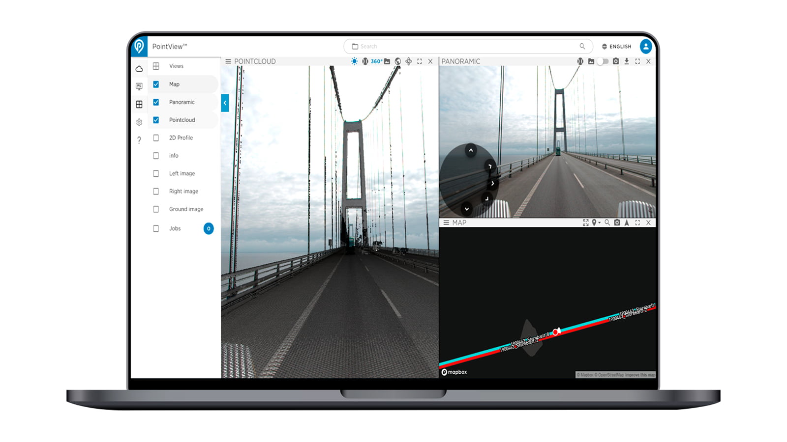
Around 20 road authorities in Denmark have already had parts of their road networks mapped by our big brother, LE34, using Mobile Mapping. IT34 makes the accurate og huge volumen of data accessible with PointView™. It has made the life easier in the municipalities of Fredericia and Aalborg.
PointView® makes it easy to use survey data
The huge volumes of data we collect using laserscanning can cause a standard computer to crash. For this reason, we developed the PointView® web viewer which enables our clients to access data via their browser. Staff at the municipalities of Fredericia and Aalborg can perform surveying, registration and design activities easily and intuitively without needing to be a 3D specialist or to use special programs.
They can go into PointView® at any time during the design phase and take a measurement or check a detail – no need to leave the office or order a new survey because measurement of a pavement elevation was initially omitted. With Mobile Mapping, everything is surveyed in one fell swoop and is readily available throughout the work process – both to the municipality’s own employees and to any affiliated consultants.
Morten Kurtzman Svanborg, head of Roads and Parks, Municipality of Fredericia
“The roads were surveyed using Mobile Mapping on the Tuesday, we put the files into PointView®, and the consulting engineer started designing on the Monday. All in all, we surveyed and designed two cycle path projects in three and a half weeks and then began construction work. We could never have done that using traditional land surveying methods.”

Construction work rests on a detailed foundation
The high degree of accuracy and the many details in the 3D model in PointView® make it possible to design new pavements, cycle paths, roads and parking spaces to the minutest detail. This minimises the risk of error and the need for adjustments during construction work.
Mads Rytter Asferg, engineer, Municipality of Aalborg
‘Due to the data collected in the form of images and a point cloud in PointView® our need for inspections and to conduct our own surveys in the field is substantially reduced.’
Find out more

Contact us
Feel free to contact us if you would like to know how to get started with PointView?
Frank Rasmussen
CTO, Business Manager
IT34 Copenhagen, Denmark
+45 2065 2029
it34@it34.com