FieldGIS™
Services
FieldGIS™ is the intelligent app from IT34 for GIS registration and data collection. It is a structured solution for digitizing data on the move, in the office or in the field.

Intelligent and structured data collection
FieldGIS™ ensures operational optimization through rapid data extraction, data collection in the field, structured database construction and intelligent data selection. It gives a digital overview and efficient data collection all in one tool.
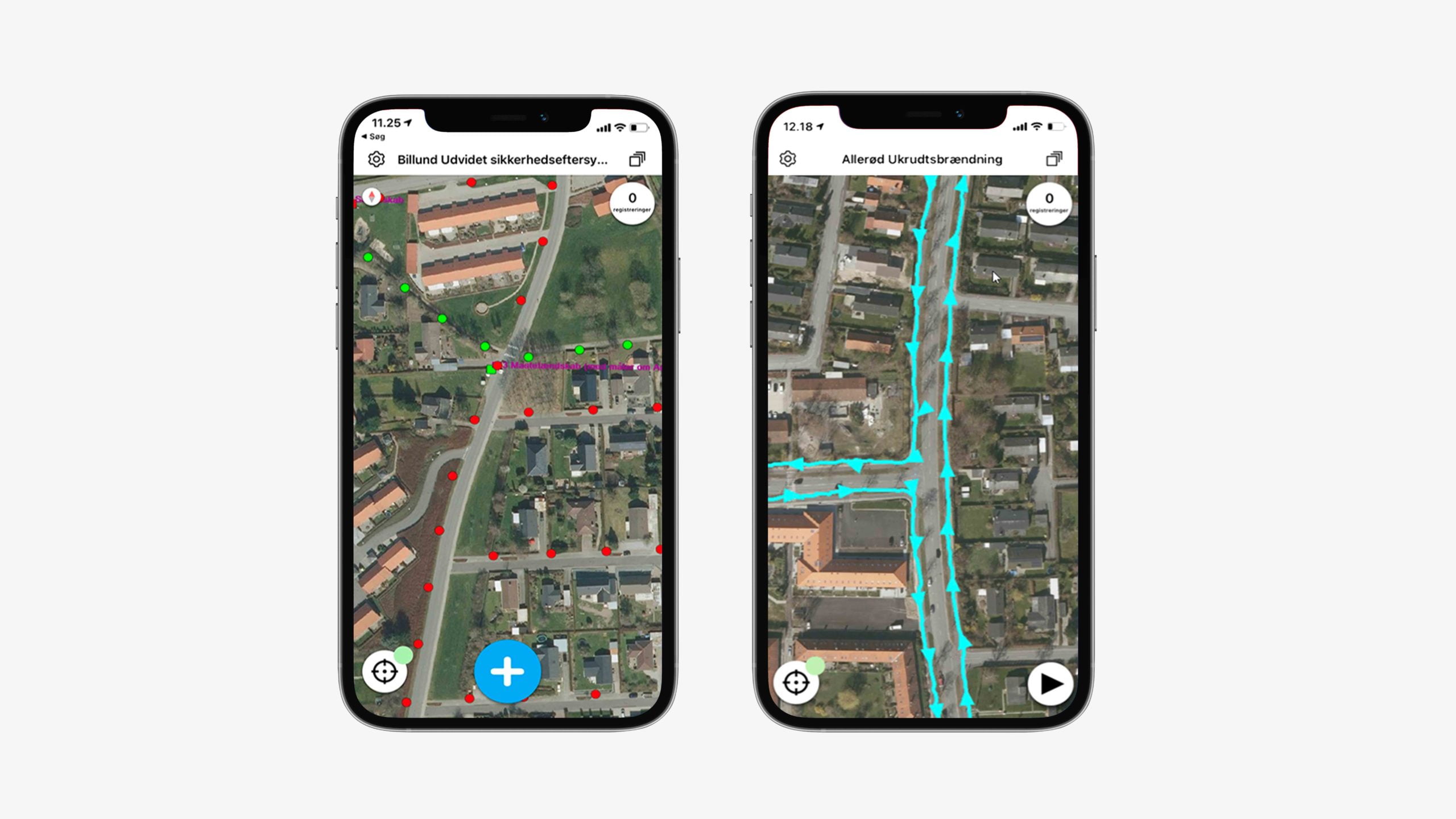
Digitization directly from the field
Fieldwork with FieldGIS™ at hand, gives you access to more than just a GIS registration tool. For example, you can quickly record geometries and changes. Also you can get a full overview of historical data and ensure sub meter registration with an external GPS. FieldGIS™ provides you with an excellent digitization tool, that enable you to take your work from your office right in to the field, and vice versa.
Intelligent data collection
FieldGIS™ sets the standard for data collection via innovative built-in intelligence, which connect your operating workflow with you field data collection.


Intelligent data collection
FieldGIS™ sets the standard for data collection via innovative built-in intelligence, which connect your operating workflow with you field data collection.
Integration for task management
Data collection from the field, directly into the office. FieldGIS™ allows you to collect task-relevant data associated with a task. Data is collected directly to the underlying Geodatabase and can be accessed via the task in GeoNote® Task Manager.
Data collection in the field takes many forms, handover documentation, area digitization, species registration, etc. FieldGIS™ gives you the opportunity to achieve all and more. The user can easily make changes to the app, so that data collection in the field takes place via a customized form-based user interface for the specific data collection task.
Automatic task flow
FieldGIS™ is part of IT34’s digital ecosystem for operations and task management. Choosing FieldGIS™ allows your organization to create intelligent and automated workflow decisions, from the field into the office. Data collected in the field marked with specific information, can generate administrative tasks for relevant employees, anywhere in the organization.
Torbjørn Mandahl Pedersen, Business Manager for LE34 Utility
“FieldGIS™ can help your staff work more efficiently every day with a digital overview and an intuitive solution.”
Possibility of RTK integration
FieldGIS™ allows for the use of external GPS devices, as well as support for RTK (Real Time Kinematics). Data collection has never been easier. With the option of connecting to RTK services, sub-meter precision is at your hand. Do you only occasionally need access to RTK? No problem, IT34 offers the opportunity to purchase access to RTK on a daily basis. You get full access to the sub-meter collection, with all the benefits of data collection and RTK at a low one-time price, instead of an ongoing subscription. Contact us today and start your data collection with FieldGIS™ RTK.
IT34 WebGIS™ integration
FieldGIS™ cooperates seamlessly with IT34 WebGIS™. Data collected with FieldGIS™ is easily displayed in IT34 WebGIS™, and creates more value through data management capabilities. IT34 WebGIS™ is a web-based tool, built on open standards. The system is easily integrated with other software from IT34, so that the overview and further processing of data can be performed in already established, or preferred systems. IT34 always has a handful of developers ready to ensure your integration.

Torbjørn Mandahl Pedersen, Business Manager for LE34 Utility
“With FieldGIS™ at hand, you have access to more than just a GIS registration tool. You have the ability to quickly detect geometries and changes directly in the field.”
The complete business value chain
Utilize a complete business value chain with FieldGIS™. Make your decision-making processes and workflows automated, and gain data insight on site. Data collected with FieldGIS™ together with GeoNote® ensures that relevant employees automatically get notified, when data is collected, or when data changes.
Use automatic data analysis and notification automation together with environmental registrations, or with leakage in utility lines, where important observations that require fast handling, are automatically placed on the employees within the subject area. Collect, analyze and execute with FieldGIS™ and GeoNote®.
Helpful features at your fingertips
FieldGIS™ consists of modules that can be selected, depending on the need. With FieldGIS™ you can combine the following functions:
• Digitization and measurement of geometry in the field
• Supplementation and updating of data base in the field
• GPS logging for history and documentation, with the option of RTK
• Data storage in an IT34 database with unique code table and data structure
• Your own rule engine for automation and efficiency
• Valuable synergies with the rest of the GeoNote® task management system
• An iOS and Android compatible solution
Why choose FieldGIS™
INTELLIGENT DATA COLLECTION
FieldGIS™ sets the standard for data collection via innovative built-in intelligence, which connect your operating workflow with you field data collection.
DIGITALIZATION IN THE FIELD
With FieldGIS™ at hand, you have access to more than just a GIS registration tool. You have the ability to quickly detect geometries and changes directly in the field.
SAVINGS
FieldGIS™ can help your staff work more efficiently every day with a digital overview and an intuitive solution.