SmartSurvey™ news
June 2026
SmartSurvey™ is a small technological revolution that converts a simple video taken on a mobile phone into a complex 3D point cloud. Stay updated with the latest SmartSurvey™ news.
New Calculation Engine and Improved SmartSurvey Data Quality
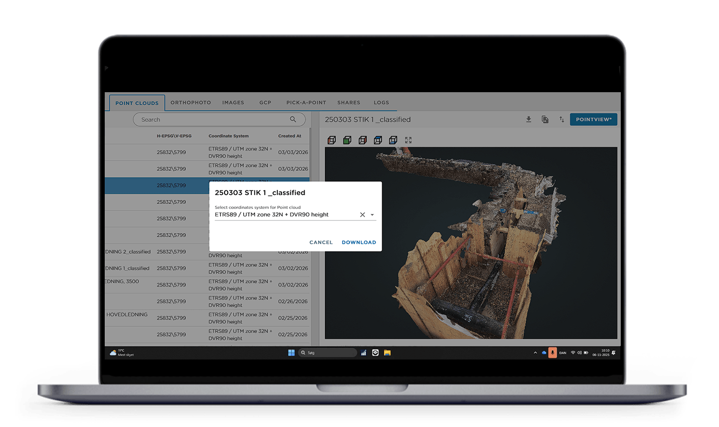
SmartSurvey™ has been working for some time on replacing the underlying calculation engine. Originally, this transition was planned to take place gradually throughout 2026, but the implementation has now been completed. As of March 2, 2026, all SmartSurvey data collected using the latest version of the app is processed on a new software platform.
The new engine has been introduced together with an updated and optimized production pipeline, improving stability, performance, and the overall calculation framework. At the same time, adjustments have been made down to the process and command level within the SmartSurvey app, ensuring more precise and consistent data processing.
The implementation reduces even very small deviations during data capture and strengthens the alignment between image data and GPS measurements. The result is a further improvement in the calculation of SmartSurvey GPS point clouds, delivering higher absolute accuracy.
The most visible impact is in the visual quality of the data. Noise levels in the point clouds have been significantly reduced, and datasets now appear sharper, more homogeneous, and easier to work with in subsequent analysis and digitization workflows.
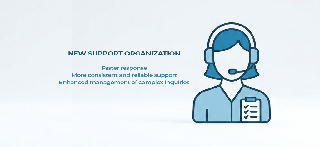
We are strenghtening our support
At IT34, we are seeing growing interest in SmartSurvey™ among utility companies, where the solution is increasingly being used as an important tool for documentation, quality assurance, and the registration of utility network data.
We are very pleased to see this development, but it also places greater demands on support, operations, and implementation.
To meet these demands, we have strengthened our support, operations, and implementation team with additional capacity and a clearer organizational focus around SmartSurvey™.
For you as a customer, this means faster response times, more consistent support, and stronger handling of both everyday questions and more complex inquiries.
At the same time, we have brought together expertise across operations, implementation, data management, consulting, and software development, providing utility companies with a stronger single point of contact for support, guidance, and technical clarification when working with SmartSurvey™.
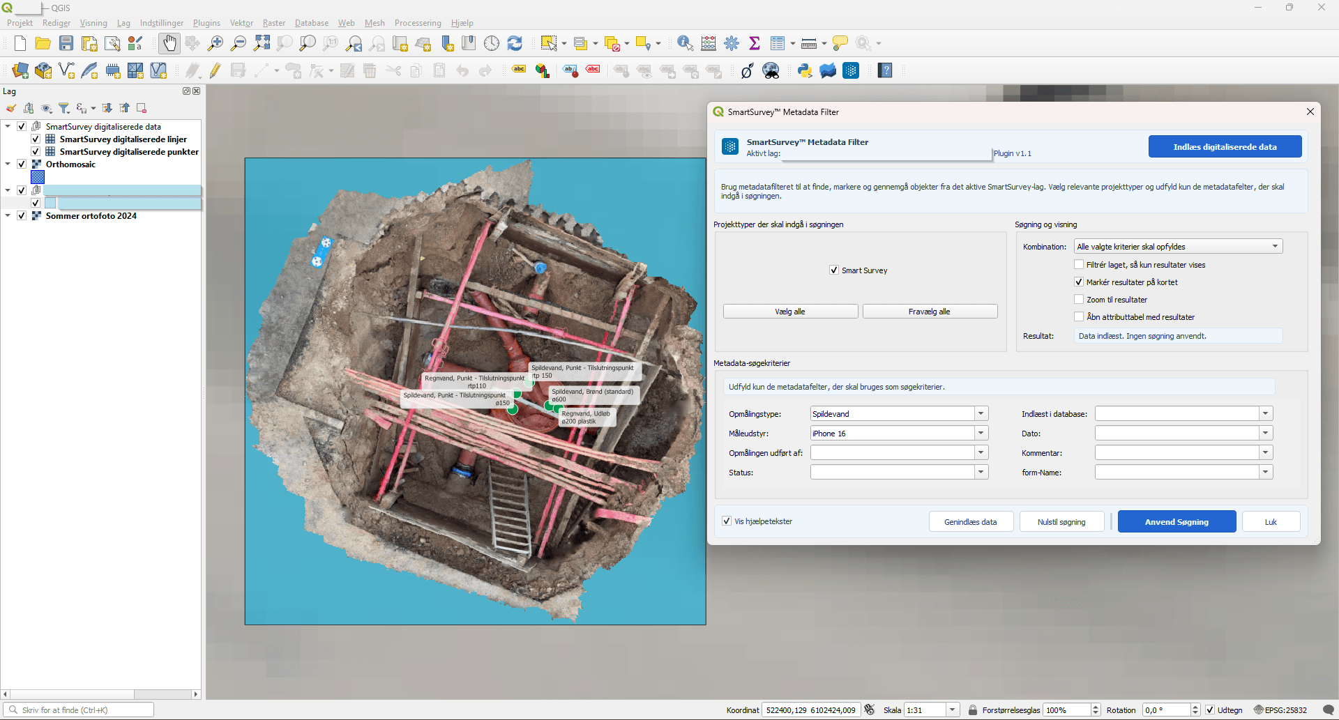
SmartSurvey™ and QGIS are moving closer together.
We are placing an even stronger focus on the connection between SmartSurvey data and its use within GIS.
As part of this effort, we are developing a QGIS integration that will provide users with a closer link between SmartSurvey™ metadata and GIS-based queries.
The goal is to make it easier to locate, filter, and utilize SmartSurvey records directly within QGIS. This will create a more efficient workflow and strengthen the connection between 3D documentation, metadata, and the day-to-day use of data in GIS environments.
Did you know that...
…SmartSurvey™ is gaining real traction in international markets?
We have already signed contracts with customers across both Europe and Asia, while also seeing strong interest from South America.
This reinforces our belief that the need for simple, fast, and accurate 3D documentation of utility and infrastructure work extends far beyond Denmark.
For us, this marks an important milestone in the development of SmartSurvey™ as a solution capable of creating value across countries, utility sectors, and operational workflows.
Få mere at vide
