Recent update of the PointView® platform
Welcome to the recent issue of the PointView® newsletter. We are thrilled to bring you the latest updates and insights regarding the PointView® platform.

Newsletter, 27.11.2023
PointView® is a web-based solution for handling, managing, visualizing and digitizing large amounts of data from various sources such as point clouds, 3D models, and interactive maps. It is designed to handle data from all scanning and imagery platforms, such as terrestrial scanning, mobile mapping, multibeam and UAV data.
What's new?
In addition to addressing numerous bug fixes and bolstering overall system stability, our focused efforts have been directed toward improving our overview map in preparation for showing orthomosaic.
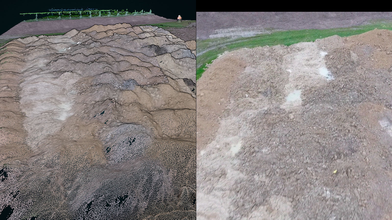
The reason for preparing to show orthomosaic is that you can now process your UAV images directly to a point cloud and orthomosaic in PointView.
Furthermore we have been focusing on improving the experience when handling data from mobile mapping and indoor scanning devices.

Main PointView® feature: Display massive amount of mobile mapping data
One of the core functionalities of PointView® is to make it easy to work with big datasets in an easy and effortless way. Mobile mapping is one of the platforms that is acquiring huge amounts of data in a short amount of time. PointView display the data seamlessly directly in your browser.
In summary, PointView® offers a comprehensive solution for professionals engaged in Mobile Mapping, providing the tools and functionalities necessary for efficient data handling, visualization, and analysis in the field and beyond.

Main PointView® feature: Upload and work with data from indoor scanning devices
PointView® proves to be an ideal platform for handling data acquired through indoor scanning devices, offering seamless integration, advanced visualization tools, and efficient data comparison.
Its user-friendly interface facilitates on-the-spot analysis, while features such as direct export to CAD and GIS, scalability, and secure hosting further enhance its suitability for professionals working with intricate indoor point cloud data.

User tip
Did you know, that using PointView® to process your drone images and an open source software, you can calculate an accurate volume in less than 1 hour?
Special features
PointView® is such a versatile platform that almost any kind of point or pixel data can be uploaded and used on the platform.
We have been building such a broad array of import functionalities, that PointView® now supports data from MobileMapping, UAV, Terrestrial laser scanners and Bathymetry etc.
Especially processing of UAV data has been our focus for the past months and now we have a robust workflow for our users to upload their own UAV images and process the data directly to point cloud and soon also orthomosaic.
Get in touch
