SmartSurvey™ news
March 2026
SmartSurvey™ is a small technological revolution that converts a simple video taken on a mobile phone into a complex 3D point cloud. Stay updated with the latest SmartSurvey™ news.
New Calculation Engine and Improved SmartSurvey Data Quality
SmartSurvey™ has been working for some time on replacing the underlying calculation engine. Originally, this transition was planned to take place gradually throughout 2026, but the implementation has now been completed. As of March 2, 2026, all SmartSurvey data collected using the latest version of the app is processed on a new software platform with no links to Russia.
The new engine has been introduced together with an updated and optimized production pipeline, improving stability, performance, and the overall calculation framework. At the same time, adjustments have been made down to the process and command level within the SmartSurvey app, ensuring more precise and consistent data processing.
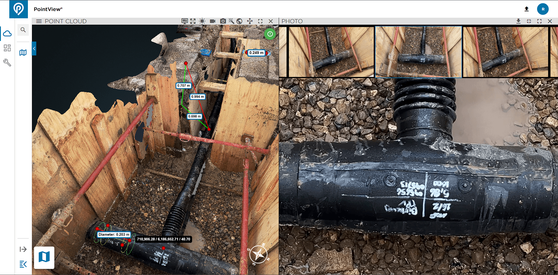
The implementation reduces even very small deviations during data capture and strengthens the alignment between image data and GPS measurements. The result is a further improvement in the calculation of SmartSurvey GPS point clouds, delivering higher absolute accuracy.
The most visible impact is in the visual quality of the data. Noise levels in the point clouds have been significantly reduced, and datasets now appear sharper, more homogeneous, and easier to work with in subsequent analysis and digitization workflows.
Download the Latest Version of the App to Access the New Improvements
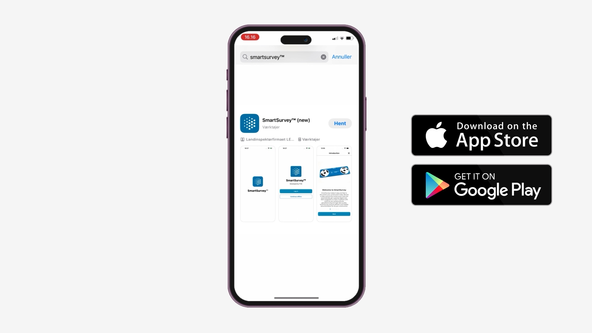
To take full advantage of the latest improvements in SmartSurvey™, we recommend updating the SmartSurvey app to the newest version.
The update ensures that your data is processed using the new calculation engine, allowing you to benefit from the improvements in accuracy, stability, and overall data quality introduced with the updated platform.
In the App Store, the new app is called SmartSurvey™ (new), and in Google Play it is listed as SmartSurvey™ v2.
By updating the app, you also ensure that future calculations follow the latest principles in our production workflow, and that your projects gain access to the ongoing improvements continuously implemented in the system.
This provides a more robust data foundation and a more consistent quality of the point clouds used for analysis, documentation, and further data processing.
Integration with Your GIS Platform – Strengthening the Data Foundation
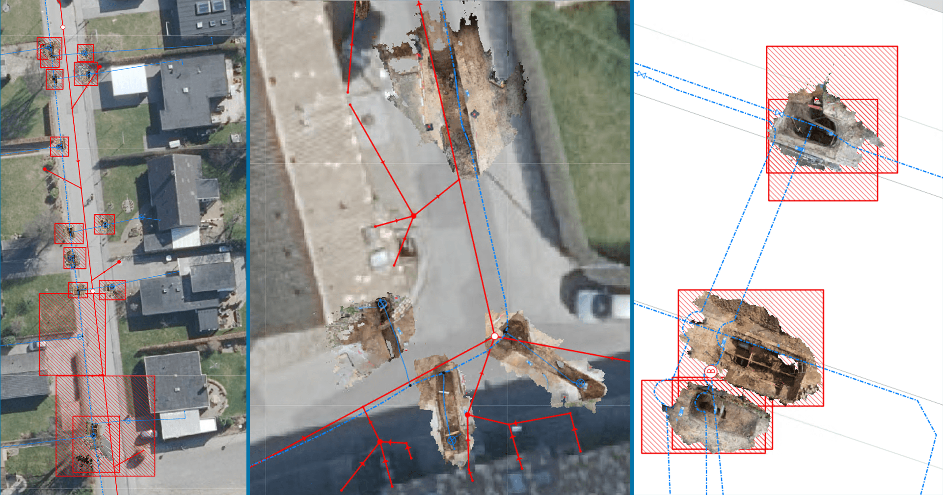
SmartSurvey™ is designed with the goal that collected data can be integrated directly into existing GIS environments. Point clouds and derived datasets can therefore be seamlessly integrated into the user’s own GIS platform and become a natural part of established workflows.
The latest improvements in the calculation process also mean that data is delivered with even higher positional accuracy. When point clouds and other datasets are placed more precisely within the correct reference system, they can be immediately combined with other geospatial data without the need for subsequent corrections or manual adjustments. This provides a more stable and reliable data foundation for further work.
In practice, this means that SmartSurvey data can be used directly in planning, design, and documentation alongside existing map and registry data. Point clouds can be used to verify registrations, supplement existing datasets, or create a visual and geometric reference framework that strengthens decision-making processes and quality assurance. At the same time, documentation for clients and authorities becomes more robust because the data is precisely georeferenced and can be retrieved within the same coordinate system as other GIS data.
When SmartSurvey is integrated into an existing GIS setup, data capture, analysis, and archiving become part of one coherent digital process. The result is a more efficient workflow where field data can quickly be transformed into usable geodata that can be stored, shared, and reused across the organization’s other systems.
Did you know...
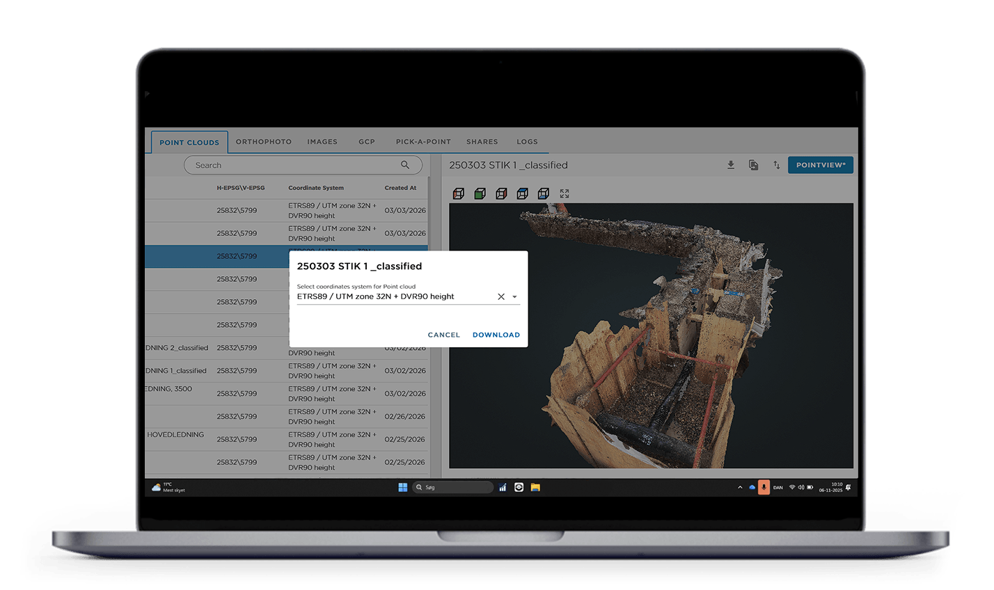
…that it is now possible to download your point clouds in a coordinate system of your choice?
When ordering a download job, you can freely select the coordinate system to which the data should be converted. The conversion is performed as part of the process, so the dataset is delivered ready for direct use in your existing GIS or project design environment.
This reduces the need for subsequent transformations and ensures a more efficient workflow from calculation to further use.
Events
User Group Meeting
SmartSurvey™ User Group Meeting – April 29, 2026
On April 29, 2026, this year’s SmartSurvey™ User Group Meeting will take place at Comwell Kongebrogaarden from 09:00 to 15:30. Breakfast will be served from 08:30.
The user group meeting is open to both active users and anyone interested in gaining deeper insight into SmartSurvey™ and PointView®. The day will offer opportunities for professional discussion, knowledge sharing, and dialogue about the future development of the solutions.
Participation is free of charge. The final program will be sent out after the registration deadline together with a calendar invitation.
Registration is completed via the personal link sent directly to you. As the number of seats is limited, we recommend registering no later than April 8, 2026.
The Program
The program is preliminary and structured into the following main sessions:
08:30 – 09:00
• Breakfast, coffee, and networking
09:00 – 11:45
• Welcome and participant introductions
• Status update on SmartSurvey™ nationally and internationally
• Product updates and technological direction
• Integrations and practical user experiences
• Interactive presentations and open discussion
11:45 – 12:30
• Lunch and networking
12:30 – 15:30
• Panel discussion and experience sharing
• Thematic sessions in smaller groups
• Presentations on use cases and new modules
• Discussion of tender materials and client requirements
• Input for further development and joint wrap-up
Get in touch
