SmartSurvey™ news
May 2024
SmartSurvey™ is a small technological revolution that converts a simple video taken on a mobile phone into a complex 3D point cloud. Stay updated with the latest SmartSurvey™ news.
AI point cloud classification with SmartSurvey™ and PointView®
Over the past few years we have trained, tested and developed a number of algorithms using deep learning and machine learning for image and object recognition of point cloud data collected with SmartSurvey™.
Now, the algorithm can automatically classify classes such as Noise, Terrain, Trench box and Pipe with high accuracy and great certainty. The ability to turn off irrelevant data in PointView® makes digitizing directly in the point cloud much easier and faster. With just a few click, you can focus entirely on your utility data.
With the latest release of SmartSurvey™, we now offer the automatic classification of point clouds as an add-on to your subscription.
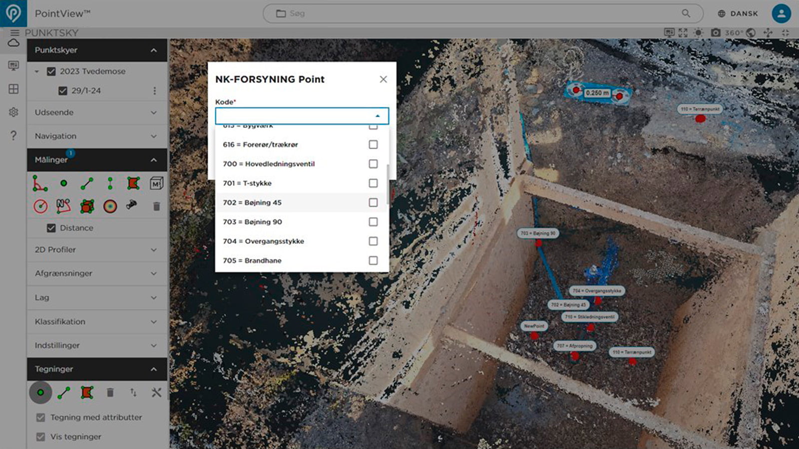
Direct registration in SmartSurvey™ data with custom code table
With the latest update of SmartSurvey™, you can register directly in the point cloud with your own code table. Digitizing data in the point cloud works similarly to surveying in the field with a GPS antenna. Once you have completed digitization in the point cloud, you can easily extract the data as a CSV file, just like extracting data from a GPS controller. Afterwards, simply load your data into GIS or forward the file to your utility data manager.
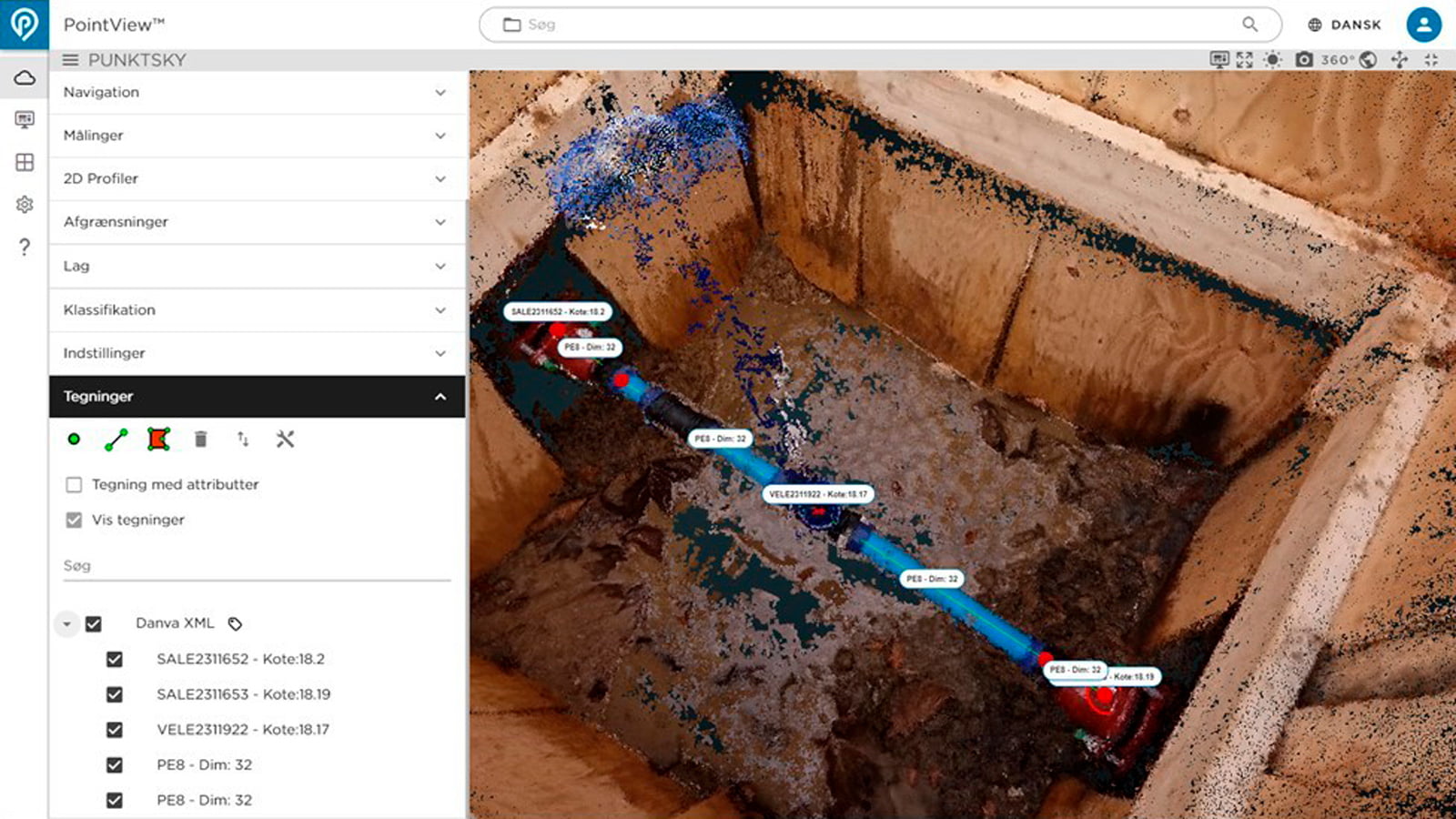
Import your Danvand XML data into PointView®
Our web-based viewer PointView® can now load and display Danvand XML data. This is the first time a stable and proven method has been established for viewing your pipe data directly in the point cloud with types, codes, materials and dimensions. When you combine the point cloud, Danvand XML data and high-detail images, you get a unique overview of your utility data directly in PointView®.
Get in touch
