PointView® Feature Extraction
Services
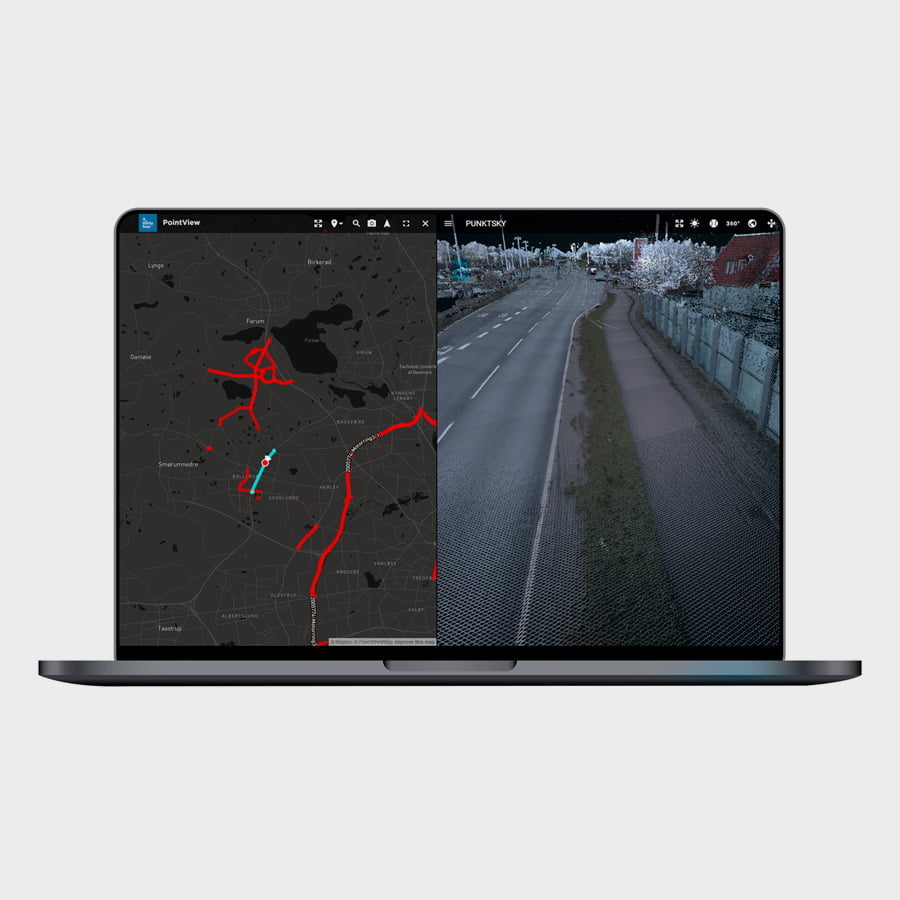
PointView® is a complete platform for handling, visualizing and digitizing point cloud data. Feature Extraction is the first step towards digitizing selected objects in point clouds.
Feature Extraction in PointView®
PointView® offers a wide range of tools for identifying, selecting and exporting a variety of objects from the point cloud.
Feature Extraction in PointView®
PointView® offers a wide range of tools for identifying, selecting and exporting a variety of objects from the point cloud.
First step towards a digital version of reality
Data collection is often born of a need to make a change, and a point cloud can be the basis for a construction project where a highly detailed point cloud can be generated. Mapping via point clouds creates a strong overview, compared to traditional surveying with a total station, as it allows you to measure pretty much everything with point clouds – even the points you did not think about. With traditional tools, this could be a weakness – how do you navigate and extract the features that are necessary for further work? PointView® offers a number of tools that make the starting point for further work easy.
Start designing from the point cloud
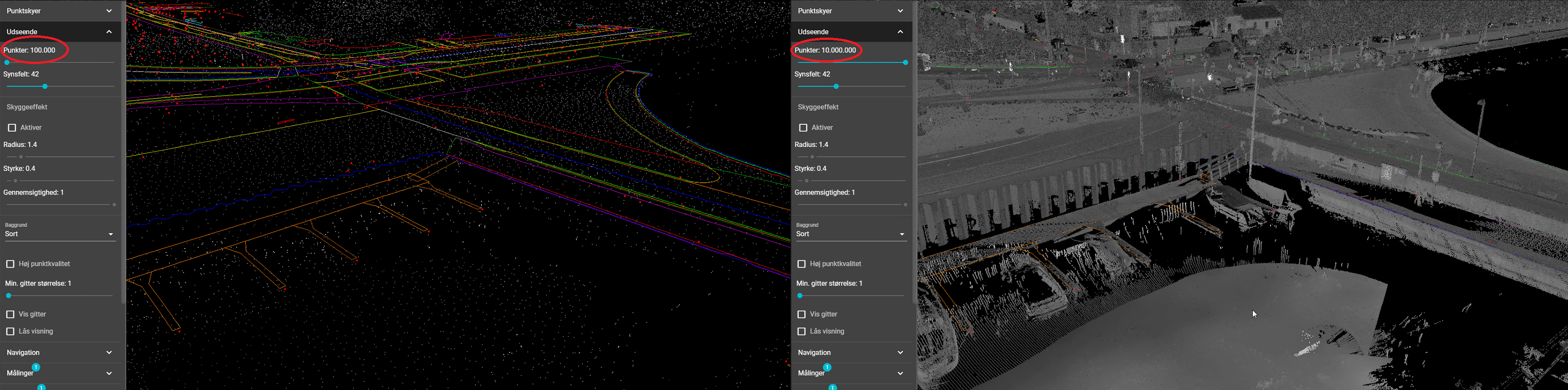
Data is good, and a lot of data is even better – but only if you can access and navigate through it easily . The purpose of extracting a data set is often that it is desired to work further with the data set. From here, digitization can begin. It could, for example, be a data set that is extracted for the purpose of obtaining a geographical overview of a number of assets for use in optimizing operation and maintenance systems. Other purposes may be to use the data set and the content of the point cloud for further design and digitization.
From here, the journey can continue for data for practical purposes, eg where selected objects are moved into a GIS system, or data is exported to external CAD systems. Feature Extraction is thus the first step in moving important data sets for further processing in a professional context.
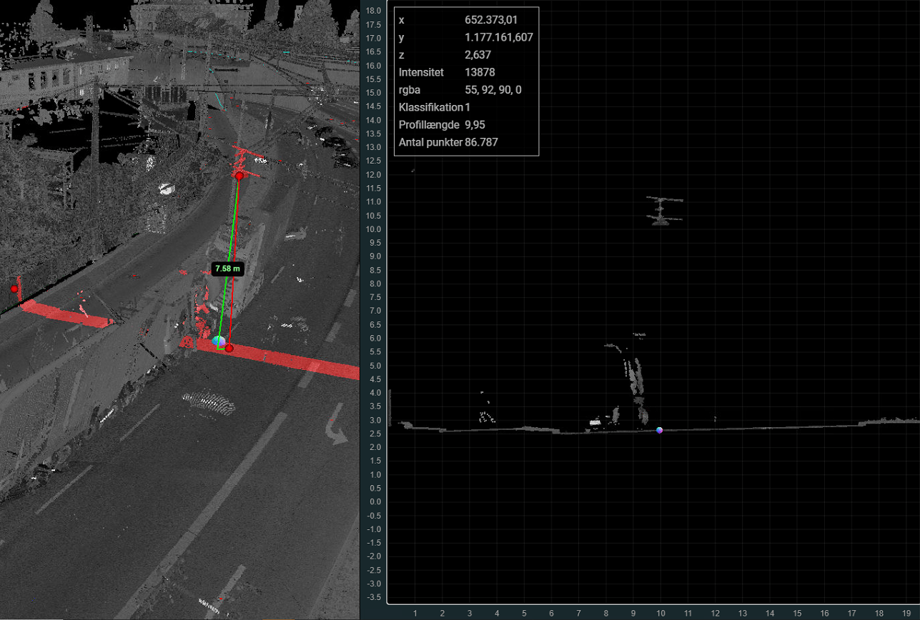
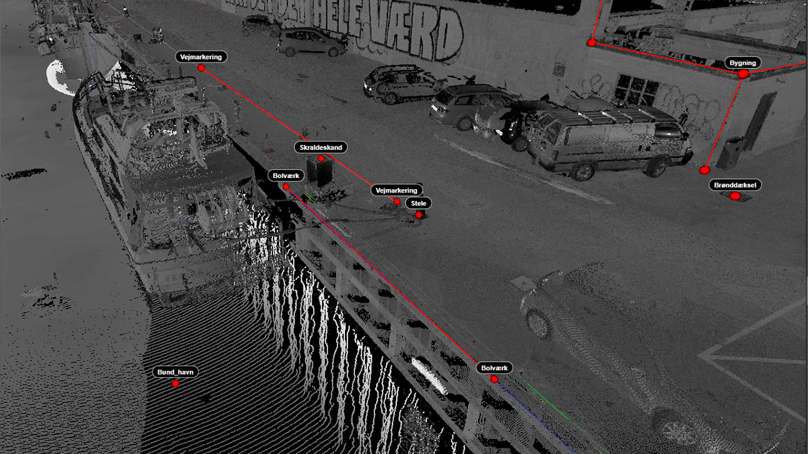
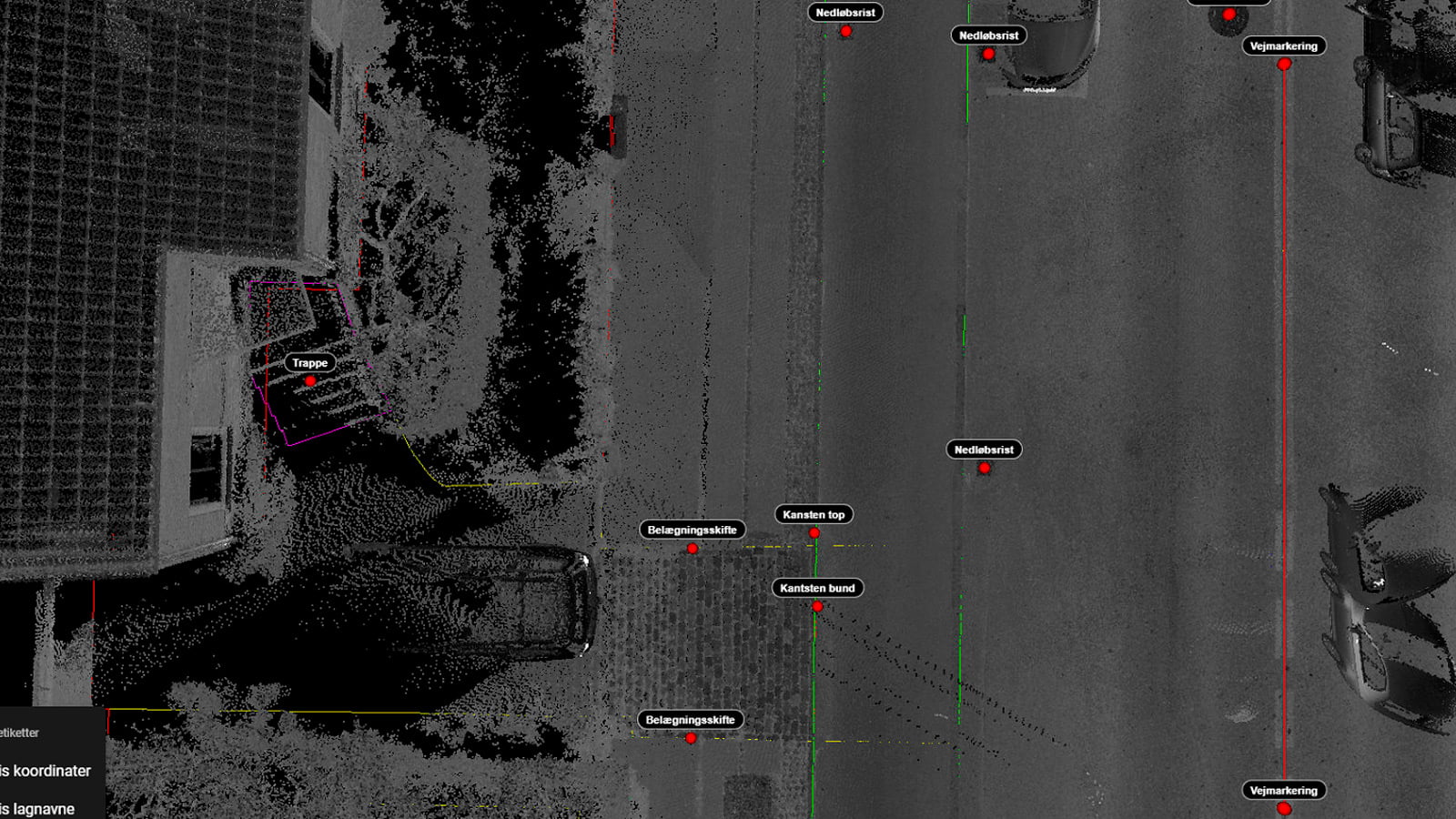
Identify and extract objects with Feature Extraction
The starting point for object extraction is the scan types used and it depends on the purpose. Extractions in PointView® are often made on the basis of the types of data below.
• Offshore surveying via Multibeam Scanning, where, for example, bridge piers, the seabed, or a fairway in a harbor entrance can be extracted.
• Drone surveying via Photogrammetry, where, for example, a terrain model can be made that can help estimate earthworks and planning conditions.
• SLAM data via Laser Scanning, where, for example, a building is measured with an indication of building parts, staircases and facade elements can be extracted as objects. This will typically take place with renovation and documentation of existing conditions.
• Mobile Mapping via Laser Scanner and 360-degree camera, where railways, airports, tunnels, bridges and infrastructure are most often measured.
• Terrestrial Laser Scanner, which is a highly detailed survey of, for example, building parts, structures and warehouses, industrial halls. Here you can extract the elements that are of interest for, for example, design or maintenance.
• SmartSurvey data from our own developed surveying system for the mobile phone can be used to advantage as a starting point for extracting and digitizing, for example, water pipes or wells from an excavation.
Extract the data sets you need
Regardless which objects you need to extract, PointView offers a seamless transition to the software used in your company.
Extract the data sets you need
Regardless which objects you need to extract, PointView offers a seamless transition to the software used in your company.
Get started today
IT IS EASY TO GET STARTED
PointView® makes it easy to carry out all kinds of measuring, registration and documentation directly from your screen. Navigate seamlessly through 3D mapping data, overview maps, panoramic images and point clouds. It is user-friendly, intuitive and cost-effective.
Go to PointView® and create a user and you are ready to upload your data. You are also welcome to play with our demo data, accessible in PointView® directly from the map view.
Why choose an IT34 solution?
EVERYTHING IN ONE PLACE
We have united IT infrastructure, development and consulting in one place. This allows us to develop tailor-made software, advise on the best IT setup and provide ongoing support. Independently of each other or in an overall solution.
UNIQUE EXPERTISE IN GEODATA
Our professional set-up includes some of the world's leading experts in geographic data, register data and GIS data. We are with you from first idea to finished solution.
INNOVATION IS OUR DNA
Our developers are shaped by the Scandinavian approach to innovation, design and user experience. We believe in simple solutions to complex problems.