PointView®. A world of data at your fingertips
Services
Experience the freedom of a web-based solution that gives you access to massive amounts of data from a user-friendly tool directly in your browser. We needed an intuitive workflow for exchanging and managing point clouds, 3D models and detailed interactive maps. That is why we developed PointView®.
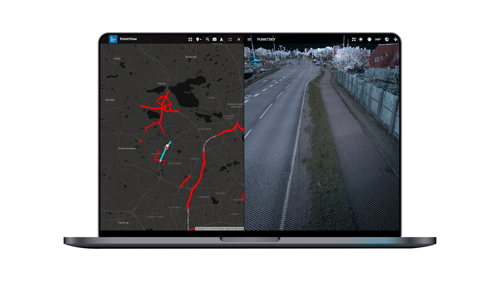
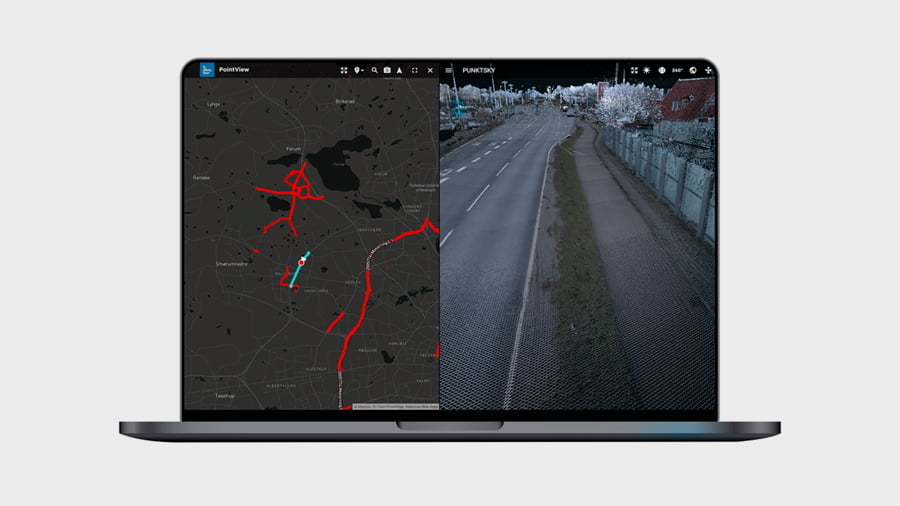
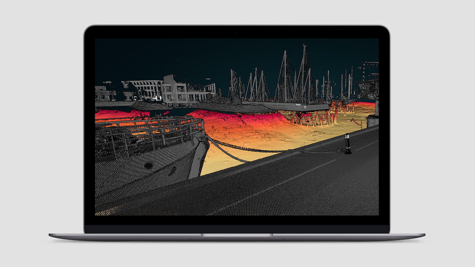
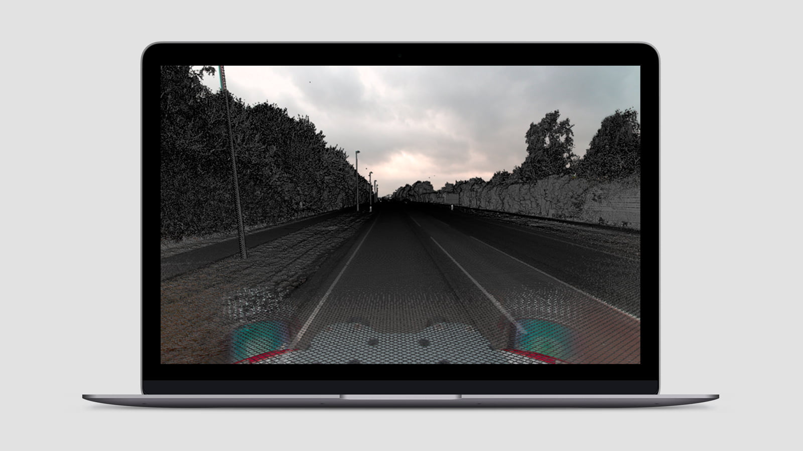
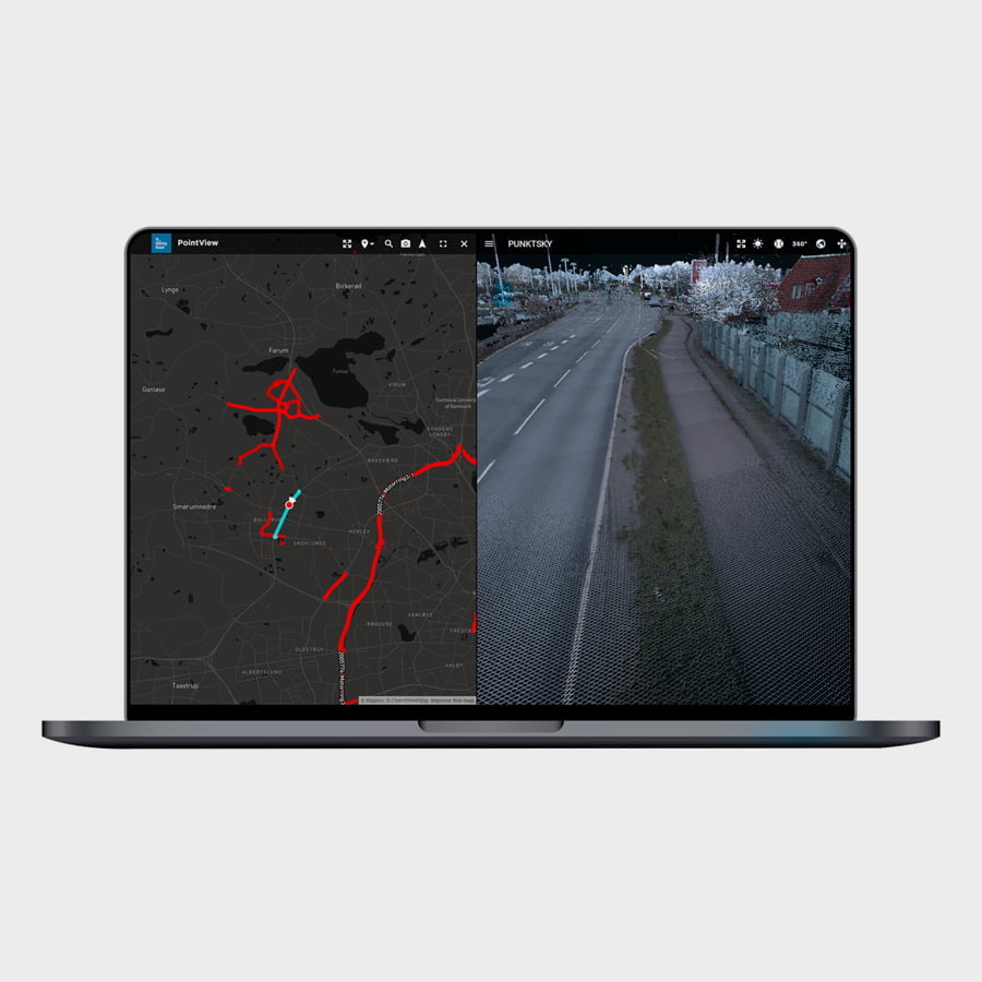
PointView® can handle data from all scanning methods – on land, at sea and from the air. It is the perfect tool for managing data from all sources ranging from terrestrial scanning and mobile mapping to multibeam and UAS data.
Reality 1:1
Documentation, inspection and control can be performed from your screen, where the digital twin allows you to identify foreign objects, share as-built documentation or track progress both above and below ground. The powerful digitization tools in PointView® help you achieve new heights for quality in decision-making processes, project management and visualizations.
Live demo access
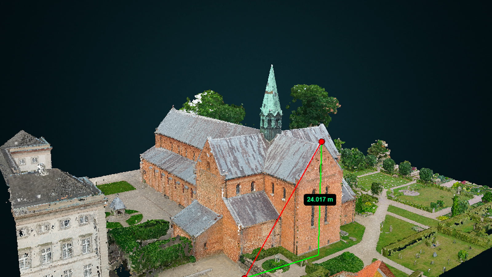
Explore Sorø Kirke in its digital form on PointView® and play freely with the functions.
Live demo access
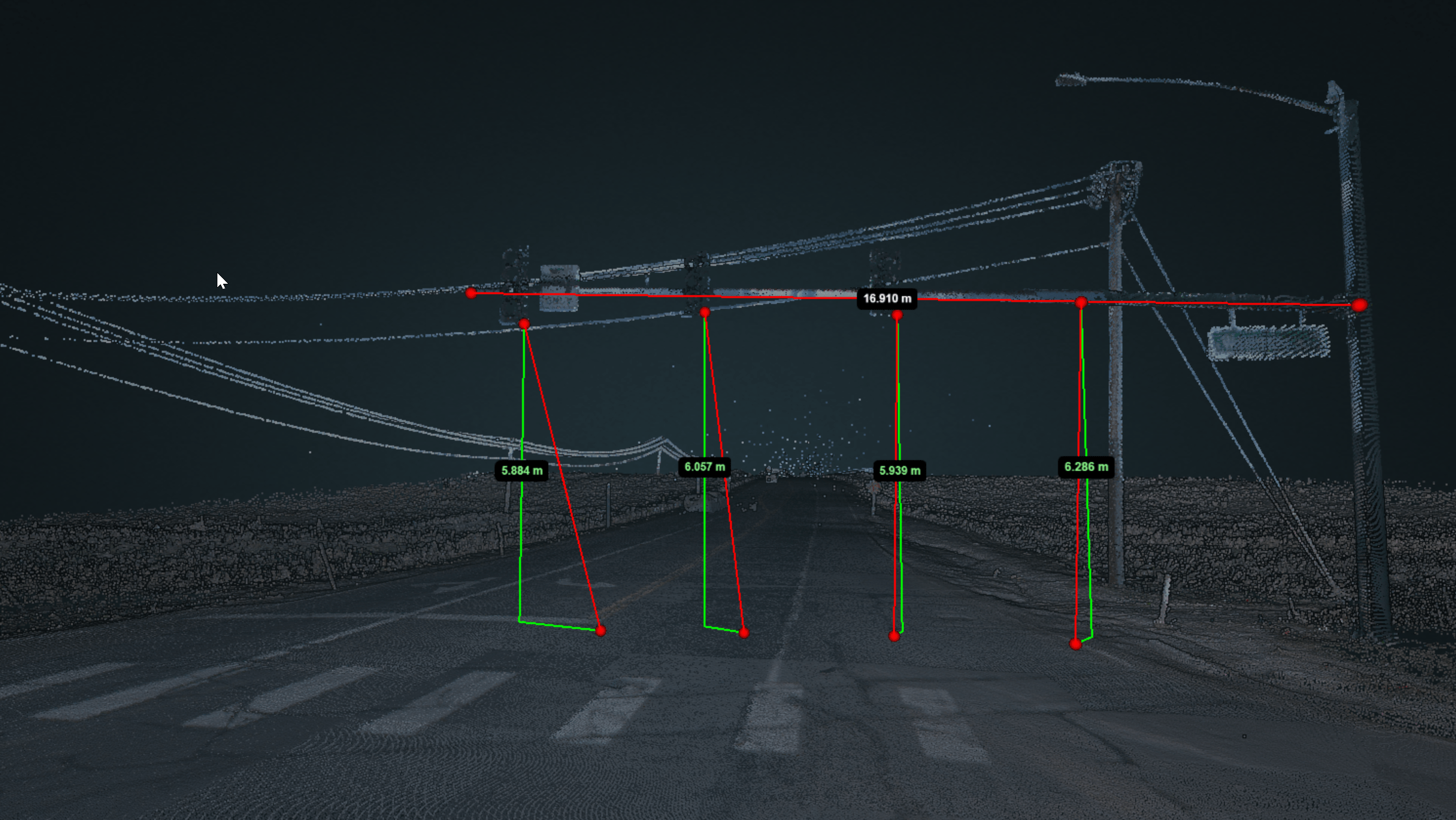
Navigate, measure and test the functionality on this point cloud from Colorado in USA.
Live demo access
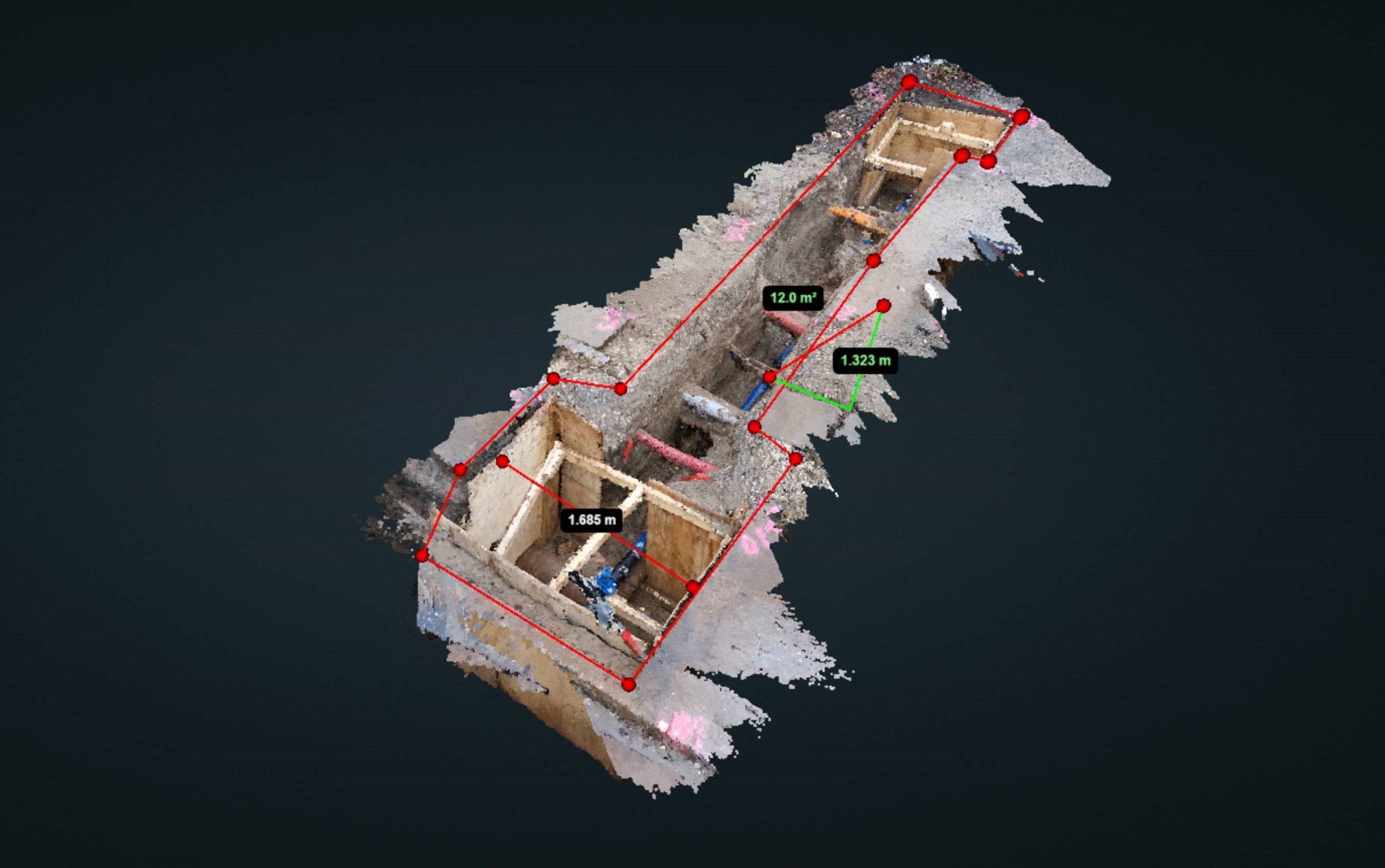
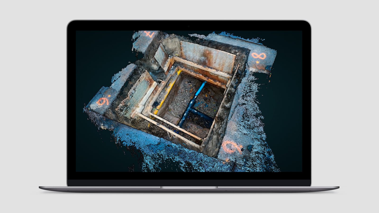
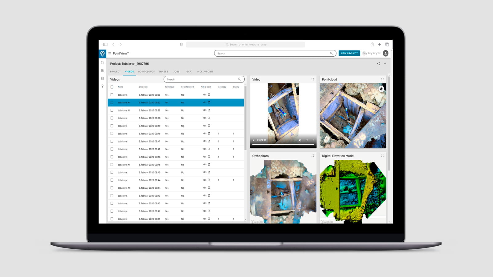
Experience the wealth of information that can be captured by point clouds in an excavation site.
Watch the video demo
• Intuitive and user-friendly
navigation in point clouds
• Versatile visualization of point clouds
• Measuring tools for measuring single points,
lines, surfaces and volumes
• Create and display cross sections
• Export subsets of data to CAD software
such as Autodesk and Bentley
• Digitize directly in the point cloud
and export your data
• Upload new datasets
• Handle several data types in one solution
• Compile and compare multiple
point clouds in layers
• Add layers to point clouds on top of
360 degree images
• Handle all known coordinate systems
(with EPSG code)
• Scalable data volumes ensures high performance
Reduce costs and make heavy data accessible for everyone
PointView® allows you to share, manage and analyse point clouds, 3D models and imagery from all kinds of sources and survey methods. Handle huge amounts of data easily and intuitively in a web browser without hardware and software requirements.
PointView® makes it easy to perform any type of measurement, compile different data sets and compare data from different stages of your project. Reduce costs and minimize the need for extra surveying and unnecessary inspections on-site with an accurate and visual reality data base.
Safety and quality
Data uploaded to PointView® is hosted in Scandinavia, which is a data center region favored by major tech companies such Google, Facebook and Apple. In addition, our data center is located close to our developers, which allows us to guarantee a high level of security, redundancy and speed.
Hosting of PointView® data
All data in PointView® is hosted in Scandinavia – the data center region favored by Google, Facebook and Apple – where we are present and can guarantee a high level of security, redundancy and speed.
Feature Extraction
You are always free to extract elements from your point clouds and display them exactly where you want. We call this Feature Extraction.
Integrations
PointView® can be integrated with API access to other software, for example to software solutions such as Bentley®, WFS solutions or your own CAD systems.
PointView® Dashboard
Meet PointView® Dashboard – your complete overview of projects and data in PointView®. Georeferencing, user management and data management become a breeze through access to the Dashboard.
Features and data types
PointView® has a wealth of features, such as geometric measurement tools, historical view, scan and image view, digitization tools and much more. Learn more about how the features will support your data types and optimize your work processes.

Service and support
Talk directly to the developers: Our experts are always available to guide you to get started with the system or to tailor PointView® to your specific needs. We work with a high service level and short response times.
Get started today
It is easy to get started
PointView® makes it easy to carry out all kinds of measurements, registration and documentation directly from your screen. Navigate seamlessly through 3D mapping data, overview maps, panoramic images and point clouds. It is user-friendly, intuitive and cost-effective.
Go to PointView® and create a user and you are ready to upload your data. You are also welcome to play with our demo data, accessible in PointView® directly from the map view.
Kim Baltzer Kallestrup, Project Manager, Aarhus Water Supply
“We expect a lot from the visualization platform PointView® – and we are already experiencing great interest from our other partners to use it and experience an even more flexible and efficient work process in our collaboration with contractors and consultants.”
Why choose PointView®?
ACCESSIBILITY AND COST REDUCTIONS
All data becomes available to everyone in your team in an intuitive and user-friendly overview directly from a browser - completely without heavy machine requirements and expensive licenses.
REALITY 1:1
With PointView® we have made it possible to perform all kinds of surveying, registration and design directly from your screen.
QUALITY AND SECURITY
All data in PointView® is hosted in Scandinavia, which is a data center region favoured by major tech companies such Google, Facebook and Apple. In addition, our data center is located close to our developers, which allows us to guarantee a high level of security, redundancy and speed.