SmartSurvey™ news
September 2024
SmartSurvey™ is a small technological revolution that converts a simple video taken on a mobile phone into a complex 3D point cloud. Stay updated with the latest SmartSurvey™ news.

Related products
Newsletter | September 2024
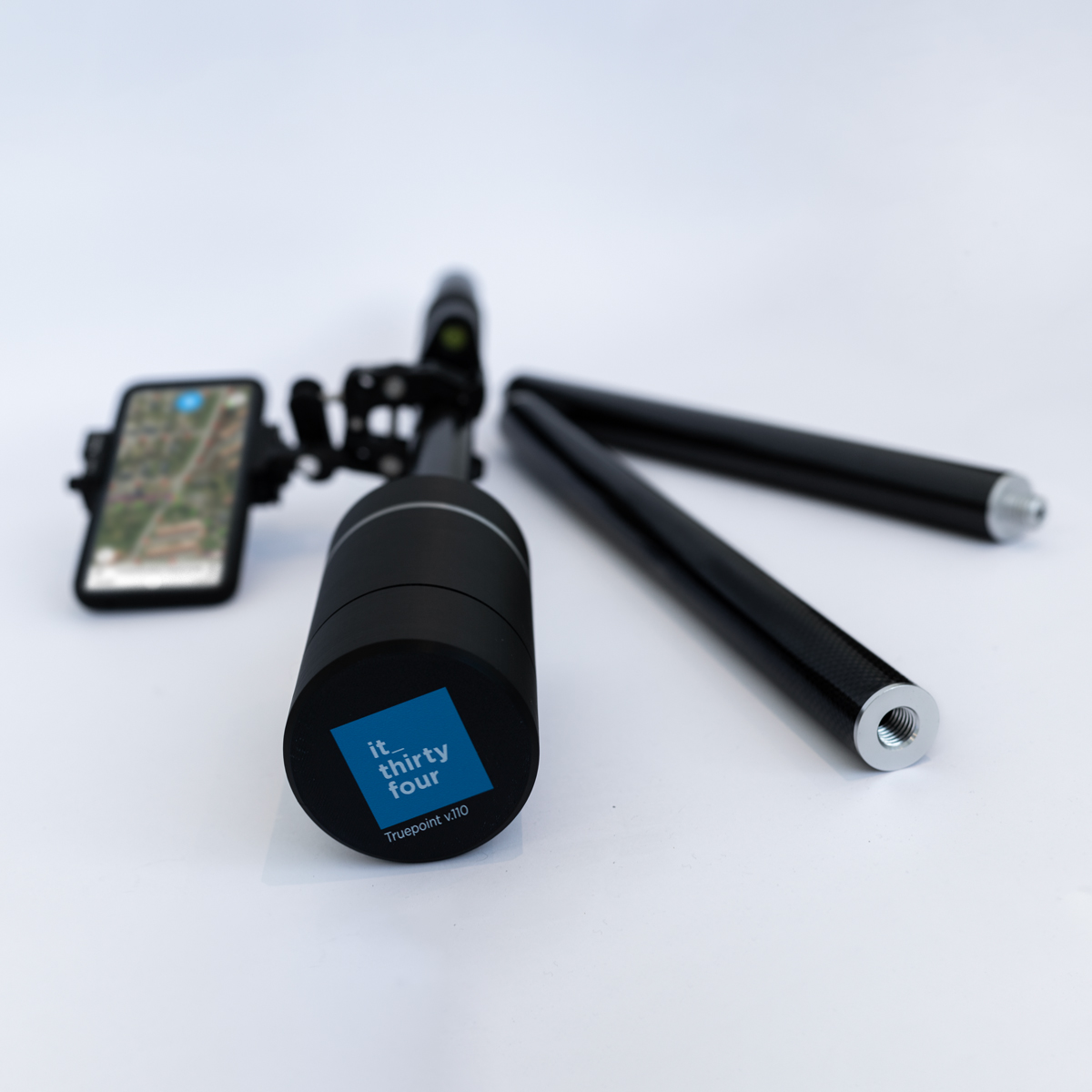
Over the past year, we have developed a GNSS/GPS antenna that fully integrates with SmartSurvey™. With its high accuracy, ease of use and solid design, TruePoint™ is made for 3D data capture, surveying and data collection with centimeter precision.
Connect SmartSurvey™ to TruePoint™
With TruePoint™ we have made the complex simple. To improve data collection and simplify workflows, we have produced our own GNSS/GPS that fully integrates with SmartSurvey™.
We offer the solution fully integrated with the SmartSurvey™ app so it’s ready to use immediately and as a side benefit, the exact same setup supports FieldGIS™, our app for GIS registration and data collection.
Connect with a single click and start your surveying, registration or data collection. Simple and efficient.

Optimize. Data you can trust.
Weighing only 430g with a battery that last for 24 hours, TruePoint™ is truly a reliable GPS solution for high-accuracy surveying, data collection and registration.
Optimize. Data you can trust.
Weighing only 430g with a battery that last for 24 hours, TruePoint™ is truly a reliable GPS solution for high-accuracy surveying, data collection and registration.
Improved AI classification
We have trained the classification algorithms to identify and classify district heating pipes so that it is no longer only water pipes that are detected.
With this optimization comes a more complete overview of the pipe network. Now, irrelevant data can be easily filtered to focus on pipes only.

New feature added to image inspection
Our image inspection module has been updated to make image selection even easier. We’ve added a new feature that makes it easy to select the image that you find most telling.
Direct integration to GIS through WFS
To facilitate the management data utilities use on a daily basis, we have developed an easy and simple integration to GIS via WFS service.
By loading our WFS service, you can pull information directly from SmartSurvey™ into your existing GIS, bringing all data into one place.

Upcoming: Major update to PointView®
With the establishment of HeyPipe™, it has been necessary to expand our integration with LER (The Danish Register of Underground Cable Owners).
Therefore, we have worked to implement our solutions LERGIS™, PointView® and SmartSurvey™ into one platform that provides a comprehensive overview of critical infrastructure in the ground.
This has led to a number of improvements that will be implemented in PointView®. The update is still in development with an expected release this fall. We’ll keep you tuned, before the update is released.
Get in touch
